



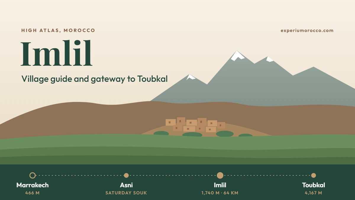
Imlil is the mountain village where most Toubkal treks begin, 64 km south of Marrakech at about 1,740 m. It is also worth a visit for its own sake: a green valley of terraced fields and earth-built villages, with North Africa’s highest peak at the end of it. Here is how to get there, what to do and when to go.
Imlil sits at about 1,740 m in the High Atlas, at the gates of Toubkal National Park. From Marrakech it is 64 km by road through Asni, about an hour and a half. You can visit it in a day, with a walk of about an hour and a half to the village of Aremd, or use it as the starting point of a Toubkal trek. It is 6 to 9 °C cooler than Marrakech all year round.
Imlil at a glance
Imlil, Morocco, is a small Berber village in the High Atlas, in the Al Haouz province of the Marrakech-Safi region. It lies in a valley that climbs towards Toubkal, at the gates of Toubkal National Park, created in 1942 and covering 380 km².
- AltitudeAbout 1,740 m
- From Marrakech64 km
- By roadAbout 1 h 30
- Toubkal summit4,167 m
Park figures: Wikipedia. Altitude, distance and drive time: our own itineraries.
How to get from Marrakech to Imlil
The road from Marrakech to Imlil is 64 km long and takes about an hour and a half. It leaves the plain, passes through Asni, a town known for its Saturday souk, then follows a green valley into the mountains. From Imlil, villages higher up such as Aremd are reached on foot or by mule.
Marrakech altitude: Wikipedia. Other figures: our own itineraries.
On our day trip, we pick you up at your hotel or riad in Marrakech, in a minibus or an air-conditioned 4×4, so you do not need to arrange transport yourself. If you want to see exactly where Imlil sits in the mountains, open the map below.
Things to do in Imlil
Imlil is not a place of monuments. You come for the walking, the villages and the mountain air, and even a short visit gives you all three.
Walk to Aremd
The classic short walk leads from Imlil to Aremd, a village inside the national park with Toubkal on the skyline. It takes about an hour and a half with a local guide, on paths through the valley, and you can ride a mule instead if you prefer. On the way you see how the valley is farmed: terraces of crops climbing the slopes, and houses whose earth walls take the colour of the mountain.
- Imlil to Aremd: about 1 h 30 on foot with a local guide, or by mule.
- Imlil to the Toubkal refuge: the first day of a Toubkal trek, about 6 hours up the valley.
- Passes to the west: the Tizi Mzik and Tizi Oudite passes lead from Imlil towards the Tamsoult refuge on our longer treks.
Villages and Berber life
The houses of the valley are built in terraces on the slopes, surrounded by crops, and life still follows the farming year. A Berber lunch in a family home or in a restaurant overlooking the river is part of our day trip, and the best way to share a moment with the people who live here.
- The film Seven Years in Tibet was partly shot in Imlil.
- Toubkal National Park supports birds such as the Barbary partridge and Levaillant’s woodpecker.


Imlil, the gateway to Toubkal
Most Toubkal treks start and end in Imlil. Mules are loaded here, and the classic path follows the valley up to the refuge at 3,207 m, past the shrine of Sidi Chamharouch. Between Imlil and the summit lie 2,427 metres of ascent, which is why the climb is split over two days at least.
On our shortest format, the 4-day Toubkal trek with summit climb, you leave Imlil on the second day and come back down to Imlil or Tamatert on the evening of summit day. Our guide to climbing Mount Toubkal covers the route, the difficulty and the best season in detail. And if you want a longer week in the mountains, our guide to Atlas Mountains trekking beyond Toubkal presents the M’Goun, Taghia and Saghro treks.
Imlil weather and the best time to go
Imlil is pleasant from spring to autumn, and it is the place to escape the heat of Marrakech in summer. The chart compares average daytime highs in Imlil and in Marrakech, month by month.
Imlil: estimates from Climate-data.org, via Wikipedia. Marrakech: Menara Airport, 1991 to 2020, via Wikipedia.
- Spring and autumn are the most comfortable seasons for walking, with highs around 15 to 22 °C.
- Summer stays bearable: July averages about 31 °C in Imlil, against nearly 38 °C in Marrakech, and nights are cool.
- Winter is cold and snowy. From December to February the average low is below 0 °C, and the climbs above the village depend on snow conditions.
Imlil in a day from Marrakech
A day is enough to see Imlil and walk in the valley without climbing Toubkal. This is how our day trip unfolds, over about eight hours in total.
- Pick-up in Marrakech at your hotel or riad, then the road to Imlil.
- Asni and the valley, with its Saturday souk and its green slopes.
- Berber villages built in terraces on the High Atlas slopes.
- Walk from Imlil to Aremd, about 1 h 30 with a local guide, or by mule.
- Berber lunch in a family home or a restaurant by the river.
- Back to Marrakech in the afternoon.
It is all part of our Toubkal National Park and Imlil day trip from Marrakech. Depending on the day, it can also include a visit to a weekly souk and, as an option, a women’s argan oil cooperative.
What to bring for a day in Imlil
Even for a day, dress for the mountains rather than for the city.
- Comfortable walking shoes and clothes you can walk in.
- A warm layer and a rain jacket: the weather can change quickly in the mountains.
- Sun protection: hat, sunglasses and sun cream, especially from spring to autumn.
- Water and a camera for the walk to Aremd.
FAQ
How far is Imlil from Marrakech?
Imlil is 64 km from Marrakech by road, about an hour and a half by car through Asni.
What is the altitude of Imlil?
Imlil sits at about 1,740 m above sea level, at the foot of Toubkal, which rises to 4,167 m.
Can you visit Imlil as a day trip from Marrakech?
Yes. A day trip of about eight hours includes the drive, a walk of about an hour and a half to Aremd and a Berber lunch, with the return to Marrakech in the afternoon.
Is Imlil the starting point for climbing Toubkal?
Yes. Most Toubkal treks start in Imlil and follow the valley up to the refuge at 3,207 m, before the summit the next morning.
When is the best time to visit Imlil?
From spring to autumn. Imlil is 6 to 9 °C cooler than Marrakech, which makes it a good escape in summer, while winters are cold and snowy.
Was Seven Years in Tibet filmed in Imlil?
Yes. According to Wikipedia, the film was partly shot in the village.