

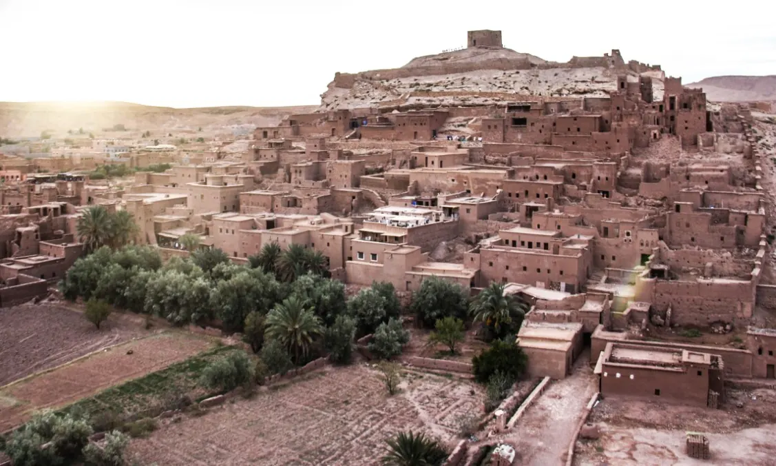
You see Ait Ben Haddou long before you reach it: an ochre hill stacked with earthen houses, towers and walls, a fortified granary on the summit and a river at its feet. It is Morocco’s most famous ksar, a World Heritage Site since 1987 and a film set for decades. Behind the postcard is a real village built from earth and timber, designed to defend itself, store grain and live close to water. This guide explains what it actually is, how it is laid out, how it is built and kept standing, how it came through the 2023 earthquake, and how to visit it well.
Ait Ben Haddou is a ksar, a fortified earthen village, in the Ounila Valley on the southern side of the High Atlas, about 180 km (110 miles) from Marrakech, or roughly 3.5 hours by road. UNESCO listed it in 1987 and calls it a perfect synthesis of the earthen architecture of southern Morocco. It came through the 2023 earthquake with only light damage. Yes, it is worth visiting: cross the river on foot, climb the lanes to the granary at the top, and go early or late in the day for the best light and fewer people.
PhotosAll photos in this guide are by Mustapha AIT ISHA, licensed tour guide, taken on his trips through southern Morocco.
What is Ait Ben Haddou?
Day trips often sell it as “the Ait Ben Haddou kasbah”, but it is neither a castle nor a single kasbah. It is a ksar (plural ksour): a fortified village built of earth, where houses are packed together inside a defensive wall reinforced with corner towers. That is how UNESCO’s World Heritage listing describes it, calling it the best-known ksar in the Ounila Valley, on the southern slopes of the High Atlas, and a former trading post on the route that linked ancient Sudan with Marrakech.
It was inscribed in 1987 for two reasons. It is an eminent example of the ksour of southern Morocco, showing the main types of earthen construction found since the 17th century in the Draa, Todgha, Dades and Souss valleys. And it bears witness to a traditional way of living that has become vulnerable to economic and social change.
As for the name, ait is an Amazigh (Berber) word meaning “those of” or “the people of”, and it appears in countless village and tribe names across the Atlas. Ait Ben Haddou simply means “the people of Ben Haddou”.
Kasbah vs ksar: the words you need
Southern Morocco has its own vocabulary, and once you know it, every village along the road reads differently. There is plenty to read: according to the Getty Conservation Institute, the south of the country holds more than 3,000 historic ksour and around 400 historic kasbahs.
- Ksar pl. ksour
- A fortified earthen village with walls and towers, home to a whole community and its shared spaces: mosque, square, granary. Ait Ben Haddou is one.
- Kasbah
- The fortified house of a caid, the local representative of power, or of a leading family. It can stand alone or inside a ksar, and is usually recognisable by its corner towers.
- Agadir
- A fortified communal granary where each family kept its grain and valuables, placed where it was easiest to defend.
- Rammed earth
- Damp earth packed in layers inside wooden formwork that is moved up as the wall rises. Known locally by the French word pisé. It makes thick, solid walls.
- Adobe
- Sun-dried mud brick. It allows thinner walls and the geometric patterns you see near the top of many towers.
Inside a ksar, from riverbank to summit
UNESCO lists the communal spaces of Ait Ben Haddou: a mosque, a public square, grain threshing floors outside the walls, a fortification with a granary at the top of the village, a caravanserai, two cemeteries (one Muslim, one Jewish) and the sanctuary of the saint Sidi Ali or Amer. We have placed the main ones on a simple cross-section, in the order you meet them as you climb.
- 1The river: the Ounila, which waters the fields and can rise after heavy rain.
- 2Fields and palm grove: the scarce fertile land, right next to the water.
- 3Threshing floors: where grain was separated, outside the walls.
- 4Walls and towers: the defensive enclosure, with towers at the corners.
- 5Houses and kasbahs: packed onto the slope; kasbahs are the fortified homes of leading families.
- 6Mosque and square: the village’s shared spaces.
- 7Agadir: the fortified communal granary, at the highest and safest point.
Diagram not to scale. Not shown: UNESCO also lists a caravanserai, two cemeteries (Muslim and Jewish) and the sanctuary of Sidi Ali or Amer. Source: UNESCO World Heritage Centre.
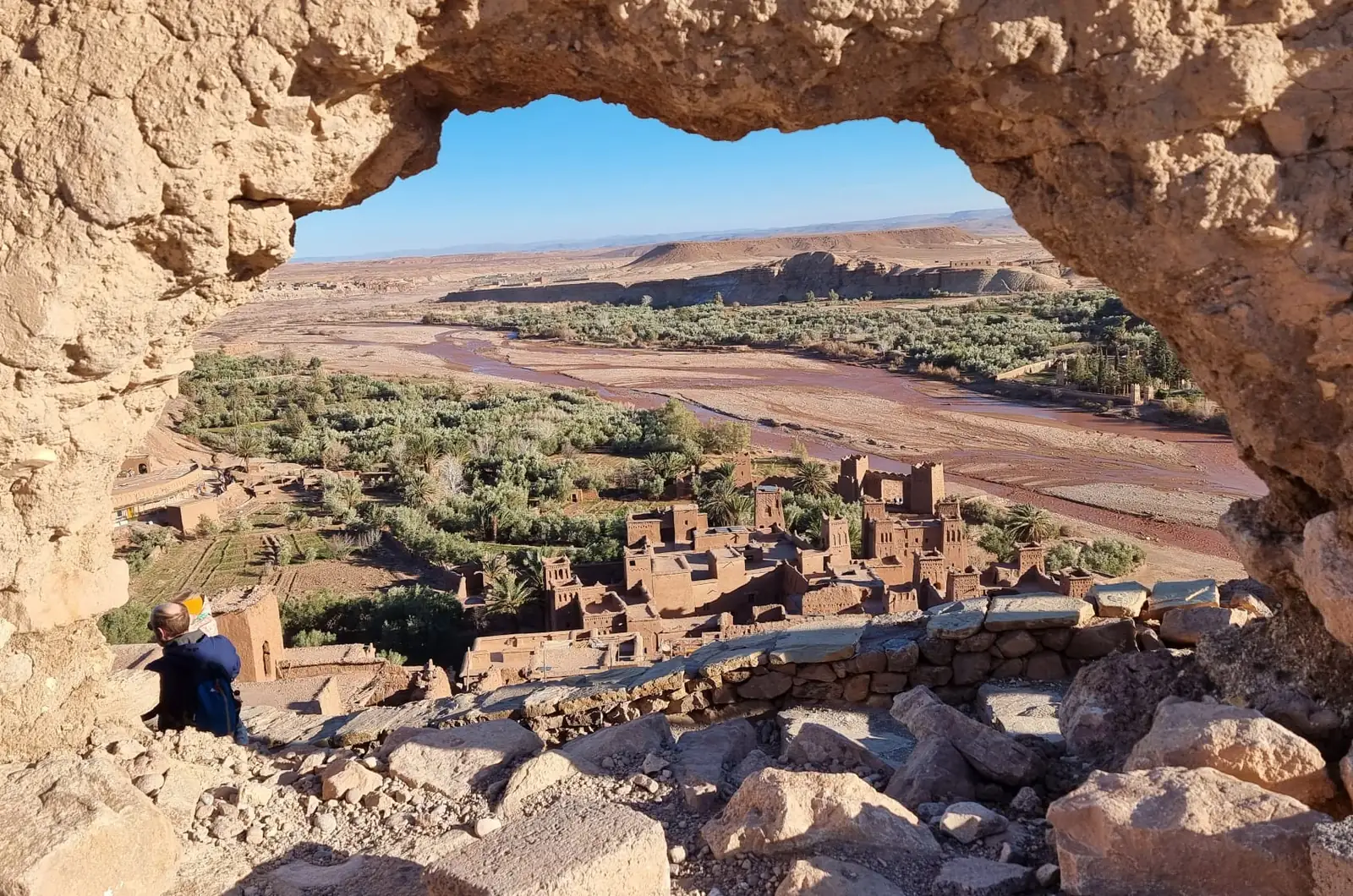
The layout follows water and defence. In the oases of the south, farmland is scarce and lies along the river, so the fields take the valley floor and the houses climb the slope behind the walls. At the very top, in the safest spot, sits the communal granary: the harvest was the one thing that had to be protected above all.
How a village is built from earth
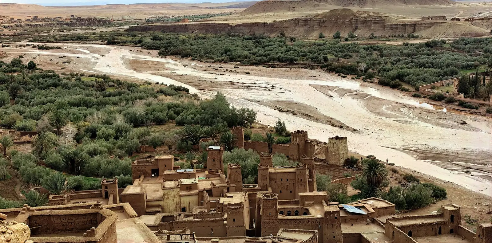
The walls of Ait Ben Haddou are made from the valley’s own soil. For rammed earth, damp earth is packed in layers inside wooden formwork that moves upward as the wall grows; adobe bricks handle the thinner sections and decorative tops. Timber is used for lintels, doors, windows and ceilings. It is architecture made from what lies around it, which is why the village is exactly the colour of the hills.
UNESCO notes that Ait Ben Haddou has kept its authenticity better than other ksour in the region. The materials are still earth and wood. Cement has only been used in a few places, such as some lintels, and is always hidden under an earth render, and the wooden doors and windows facing the lanes are protected from being swapped for metal ones.
Earth has one weak point: water, and above all neglect. A wall that is not re-rendered and repaired after the rains slowly washes away. UNESCO warns that the ksar’s buildings are very vulnerable because of a lack of maintenance, linked to residents moving out. The problem goes well beyond Morocco: UNESCO’s World Heritage Earthen Architecture Programme notes that in 2011 more than 10% of World Heritage properties included earthen structures, and that about a quarter of the sites on the List in Danger are earthen.
Was Ait Ben Haddou damaged by the 2023 earthquake?
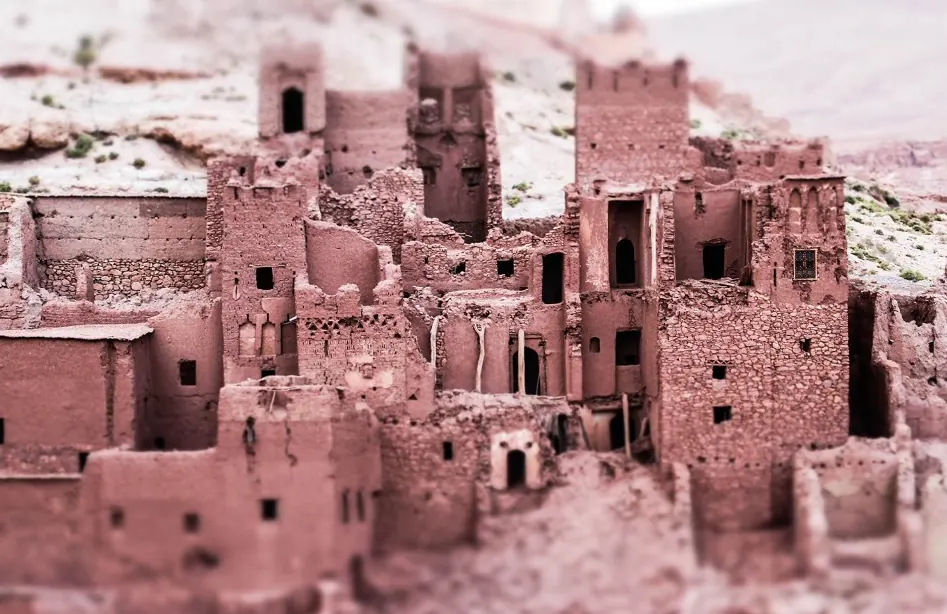
On 8 September 2023, the Al Haouz earthquake struck the High Atlas, and many travellers wondered whether Ait Ben Haddou was still standing. UNESCO’s 2024 state of conservation report summarises Morocco’s assessment: buildings restored with traditional techniques generally withstood the tremors well. One granary, known as the grenier des Potiers, collapsed, three of the five towers of its enclosure wall were damaged, seven buildings were affected to varying degrees and there were rockfalls in the south-western part of the site. The World Heritage Centre concluded that the property was only slightly affected compared with other sites.
That is a strong case for traditional upkeep: the buildings looked after with the old methods were the ones that held up best.
Do people still live in Ait Ben Haddou?
Yes, but fewer every year, and that is the site’s biggest challenge. The same UNESCO report notes that permanent residential use of the ksar is declining while shops and guesthouses grow, and asks Morocco to restart the revitalisation and community awareness work set out in the 2020 to 2030 management plan. A study published by the University of Coimbra already counted only six families still living inside the walls.
As a visitor, a few simple habits help:
- Remember that many of these houses are homes, not film sets.
- Ask before photographing people.
- Stay off walls and any roofs that are not open to visitors: earth wears away with every step.
- If you buy something, choose crafts made locally and ask who made them.
Things to do in Ait Ben Haddou
The visit is easy to plan and better without a rush. This is the natural route, from bottom to top:
- Cross the river. You reach the ksar by crossing the Ounila riverbed on foot. After heavy rain the water can rise, and flooding is one of the risks UNESCO monitors.
- Climb the lanes. Narrow streets wind uphill between earthen walls. Look out for the old wooden doors and windows and the geometric patterns on the towers.
- Step inside a house. Some houses can be visited and there may be a small charge, so carry cash in dirhams.
- Reach the granary at the top. From up here the whole layout makes sense: the ksar below, the river, the fields and the palm grove.
- Stay for sunset. In low light the earth changes colour by the minute. Early morning is quieter too.
Local guides work inside the ksar and know the story of each house, which makes a real difference to what you understand. The skyline may also look familiar: it has appeared in many films, including Gladiator and Lawrence of Arabia.
How to get to Ait Ben Haddou from Marrakech
Ait Ben Haddou is about 180 km (110 miles) from Marrakech, around 3.5 hours each way by road. The route crosses the High Atlas over the Tizi n’Tichka pass at 2,260 m (about 7,400 ft). Near the end you can turn off to Telouet and follow the Ounila Valley down, the old salt caravan route, past the Glaoui kasbah. Our Telouet and Ait Ben Haddou day trip follows exactly this road. If the mountains themselves tempt you, our Atlas Mountains trekking guide covers walking routes in the range you drive through.
A day trip is doable but long. If you have the time, staying nearby lets you walk the ksar first thing in the morning or at dusk, with fewer people and better light.
Ait Ben Haddou is also the gateway to the so-called Road of the Kasbahs. About 30 km away is Ouarzazate, with the Taourirt kasbah, once a residence of the Glaoui caids and now a national monument. Further east open the Dades and Todgha valleys, both named by UNESCO among those that preserve the main types of earthen building. Heading on to the dunes? Our guide to desert trips from Marrakech compares the options.
Ait Ben Haddou FAQ
What is Ait Ben Haddou famous for?
It is the best-known ksar, or fortified earthen village, in southern Morocco, a UNESCO World Heritage Site since 1987, and the backdrop to many films such as Gladiator and Lawrence of Arabia.
Is Ait Ben Haddou a kasbah or a ksar?
A ksar: a whole village with walls, a mosque, a square and a granary. A kasbah is the fortified house of a leading family or a caid, and a ksar can contain several.
Where is Ait Ben Haddou?
In Ouarzazate province in southern Morocco, about 180 km (110 miles) from Marrakech over the Tizi n’Tichka pass and about 30 km from Ouarzazate.
Was Ait Ben Haddou damaged in the 2023 earthquake?
Only slightly. According to UNESCO, buildings restored with traditional techniques held up well; one granary collapsed and some towers and buildings were damaged, but the site was far less affected than others.
Is Ait Ben Haddou worth visiting?
Yes, especially if you look beyond the photo stop. Knowing how a ksar works, from river to granary, turns a quick look into a real visit.
How much time do you need at Ait Ben Haddou?
As a rough guide, one to two hours to cross the river, walk the ksar and climb to the granary. Allow more if you want to stay for sunset.
Sources
- UNESCO World Heritage Centre: Ksar of Ait-Ben-Haddou.
- UNESCO World Heritage Centre: state of conservation of the Ksar of Ait-Ben-Haddou (2024).
- UNESCO: World Heritage Earthen Architecture Programme.
- Getty Conservation Institute: Conserving the Kasbah, The Getty Magazine, Summer 2015.
- Bouaouinate, Bentaleb, Dekkari and Sadik: Ksar Aït Ben Haddou: patrimonialisation, mise en tourisme et enjeux de sauvegarde, University of Coimbra.